Satellite Imagery and Deep Learning for Advanced Vegetation Mapping
In the realm of environmental monitoring and management, the integration of satellite imagery with deep learning techniques has brought about a revolutionary approach to vegetation mapping. This method, combining the comprehensive perspective of satellites and the analytical prowess of artificial intelligence, is pivotal for various sectors including agriculture, urban planning, and environmental conservation.
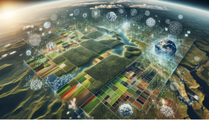
Vegetation mapping transcends mere academic interest; it's a tool of immense practical value. Yearly mapping sheds light on seasonal changes, long-term ecological trends, and human impacts on plant life. The advent of high-resolution satellite imagery has enabled us to observe the Earth's vegetative cover in unprecedented detail. Satellites like Landsat, Sentinel, and MODIS provide critical data through multispectral imagery, crucial for assessing vegetation health and distribution.
Deep learning, particularly computer vision, has transformed the way we process and interpret this data. Techniques like Convolutional Neural Networks excel at deciphering the complex visual information contained in satellite images. These AI models are trained on large datasets, learning to identify various types of vegetation. They can then categorize new satellite imagery, offering detailed and accurate vegetation maps.
The process is intricate yet robust. It begins with acquiring satellite data across different spectral bands. The models are then trained to recognize vegetation patterns, which are later used to analyze new images. The result is a map highlighting various vegetation types, densities, and changes over time.
However, the journey is not without challenges. Issues like cloud cover, atmospheric interference, and data volume present significant hurdles. Innovations are continuously being developed to overcome these obstacles, such as advanced noise-filtering algorithms and cloud-penetrating radar imagery.
The applications of yearly vegetation maps are diverse and impactful. In agriculture, they guide precision farming and crop health monitoring. Conservationists use them to track deforestation and understand climate change's impacts. Urban planners utilize these maps to enhance green spaces and manage urban heat islands.
Looking ahead, the integration of more varied data sources, like drone imagery, and the development of sophisticated AI models will further refine vegetation mapping. The goal is to achieve near-real-time mapping for responsive environmental management.
In conclusion, the combination of satellite imagery and deep learning represents a significant leap in our ability to monitor and understand Earth's vegetation. As technology evolves, our insights into the planet's ecosystems will become increasingly detailed, timely, and actionable